In this article we will learn about the methods of surveying. Surveying methods are of great importance in the field of construction and civil engineering. A civil engineer should have knowledge of these surveying methods.
Surveying is the process of determining the relative positions of different objects on the earth’s surface by measuring horizontal distances between them and creating a map to any suitable scale.
Different Methods of surveying are as follows:
Table of Contents
Primary Methods of Surveying:
- Plane Surveying.
- Geodetic surveying.
1. Plane Surveying:

Plane surveying is performed by state agencies as well as private agencies. As we know the earth is spherical in shape but its diameter is large enough to consider a plane in a small area. In this type of survey mean surface of the earth is considered as a plane and the spheroidal shape is ignored. All triangles formed by survey lines are considered plane triangles. The level line is considered straight and plumb lines are considered parallel. Plane surveying is performed of the area of survey is less than 250 km2.
2. Geodetic Surveying:
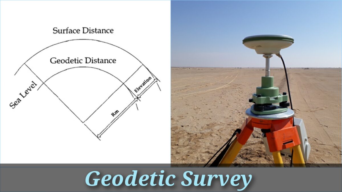
A geodetic survey is performed by the survey department of the state. In this type of survey curved shape of the earth is taken into account. The object of the geodetic survey is to find out the precise position on the surface of the earth, of a system of widely distant points that form control stations in which surveys of less precision may be referred. The line joining two points is considered a curved line and angles are assumed as spherical angles. It is carried out if the area is more than 250 km2.
Secondary Methods of Surveying:
Methods of surveying can be classified depending on the nature of the field of survey, the object of the survey, and the instruments used in the survey.
1. Surveying Based on Nature of Survey:
(a) Topographical Survey:
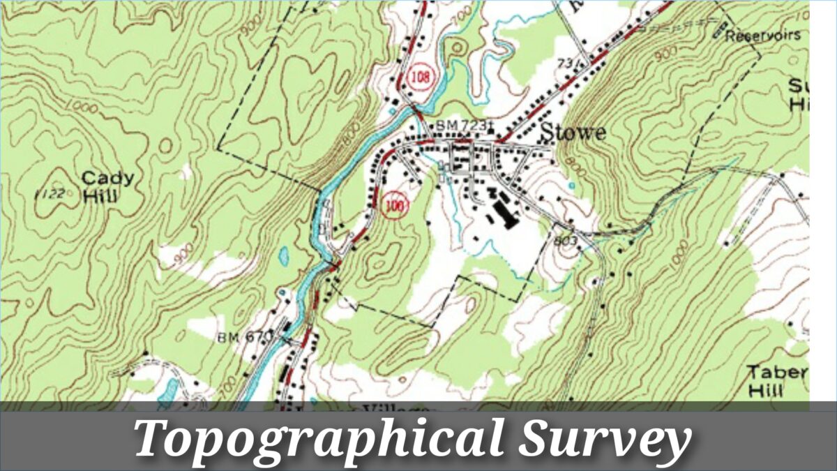
Topographical Survey performed to find out the position of natural features of a region like rivers, canals, streams, hills, roads, highways, etc. The role of such surveys is to prepare maps and such maps are called topo-sheets.
(b) Hydrographic Survey:
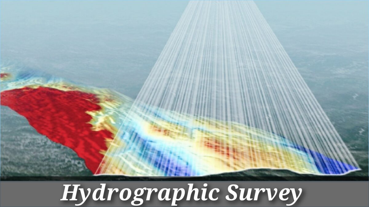
Hydrographic survey performed to find out M.S.L. (Mean Sea Level), water spread area, depth of water bodies, the velocity of flow in streams, the cross-section area of flow, etc.
(c) Astronomical Survey:

The Astronomical Survey was performed to find out the absolute location of any point on the surface of the earth. The survey consists of making observations of heavenly bodies like stars, satellites, etc.
(d) Engineering Survey:

This type of survey is carried out whenever sufficient data is to be collected for the purpose of planning and designing engineering works like roads, highways, bridges and reservoirs, canals, tunnels, etc.
(e) Archeological Survey:

This type of survey was performed to collect information about sites that are crucial from archeological considerations and for unearthing relics of antiquity.
(f) Photographic Survey:
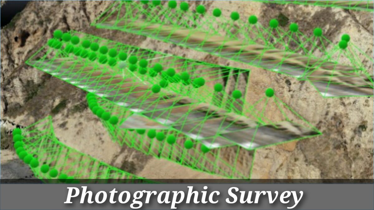
In Photographic Survey information is collected by taking photographs from selected points using a camera.
(g) Aerial Survey:

In Aerial Survey data about large tracks of land is collected by taking photographs from an aero-plane.
(h) Reconnaissance Survey:

In Reconnaissance Survey, data is gathered by marking physical observation and some measurements using simple survey instruments.
2. Surveying Based on Type of Instruments:
(a) Chain Surveying:
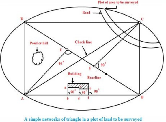
Chain surveying is the fundamental and oldest type of surveying. The rule associated with a chain survey is triangulation. This type of survey area to be surveyed is divided into a number of small triangles. Angles of triangles should not be less than 30 degrees and greater than 120 degrees. Equilateral triangles are considered to be ideal triangles in chain surveys. No angular measurements are taken, tie lines and check lines control the accuracy of the task.
This method is appropriate on level ground with little undulations and the area to be surveyed is small.
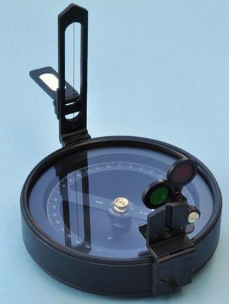
(b) Compass Surveying:
Compass surveys utilize the principle of traversing. This technique does not require the need to create triangles. It exercises a prismatic compass for measuring the magnetic bearing of a line and the distance is measured by a chain. A series of connecting lines is processed using a compass and measuring distances using a chain. Interior details to be located using offset from main survey lines.
Compass Surveying is suitable for large area surveying crowded with many details. It can be utilized to survey a riverbank.
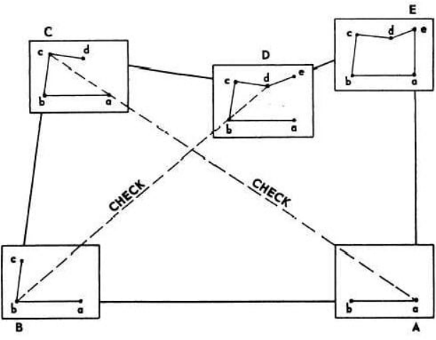
(c) Plane Table Surveying:
The principle of the plane table survey is based on parallelism. Survey details are plotted directly on paper with their relative position. The rays are drawn from station to object on the ground surface. The table is located at each of the successive station’s parallels to the position of the last station.
They are usually suitable for filling interior detailing and are advisable when great accuracy is not required.
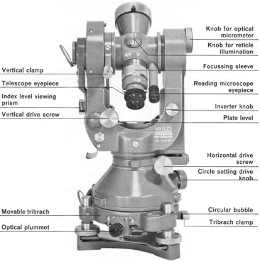
(d) Theodolite Surveying:
The theodolite is an instrument used primarily for accurate measurement of the horizontal and vertical angles. They are very accurate to measure up to 10″ or 20″ angles.
Theodolite can be used to measure:
- Horizontal angles
- Vertical angles
- Deflection angle
- Magnetic bearing
- The horizontal distance between two points
- Vertical height between two points
- Difference in elevation
Nowadays theodolite is shadowed and replaced by the use of a total station that can carry out the same task with greater ease and accurate results.
(e) Tachometric Surveying:
In a Tacheometry survey, horizontal and vertical distances are measured by taking angular observations with an instrument known as a tachometer. Tacheometer is nothing but a transit theodolite fitted with a stadia diaphragm and an analytic lens. There is no requirement for chaining in the Tacheometry survey. The principle of the Tacheometer is dependent on the property of the isosceles triangle, where the ratio of the distance of the base from the apex and the length of the base is always invariant.
A different form of stadia diaphragm is commonly exploited:
(f) Photogrammetry Surveying:
The photogrammetry survey depends on the technique of taking photographs from different angles to set up topographic details with relatively high speed.
There are two types of photographic surveying as given below:
(I) Terrestrial or Ground Photogrammetry:
In terrestrial photogrammetry, maps are prepared from ground photographs from different points on the earth’s surface for the purpose of measurement.
(II) Aerial Photogrammetry:
In aerial photogrammetry, maps are created from the air from an airplane or helicopter.
Photogrammetry embraces two major areas of specialty.
- Metrical photogrammetry.
- Interpretive photogrammetry.
Metrical photogrammetry is of primary interest to surveyors since it is applied to determine distances, elevations, areas, volume, etc. to compile topographic maps made from measurements on photographs.
Intuitive photogrammetry is concerned with objects from their photographic image and their importance. Critical factors are considered in distinguishing objects of shape, sizes, patterns, shadow.
Conclusion
These are the methods of surveying. I hope you liked this article. Thanks for reading my article.